Airport GIS Data

Airport GIS data

Airport Geographic Information System (GIS) datasets are shared free of charge. Data is updated as needed to serve the general public. More information is available at WisDOT Open Data.


Data LayerDescriptionMetadata
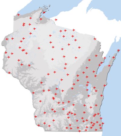
Airport Reference PointsThe center point of an airport, located at the geometric center of all the usable runways. WisDOT ARPs include public and private-use airports, heliports, seaplane bases, and ultralight facilities. Metadata
Airport Reference Point BuffersSix-mile buffer areas around each public-use airport facility. Buffer rings were developed by WisDOT based on FAA Advisory Circular (AC) 150/5200-33C and are described in Chapter 5 of the Wisconsin Facilities Development Manual to coordinate management of Airport wildlife hazard areas. Metadata
Airport Runway CenterlinesRepresent the center of the runway from the end to end and include displaced thresholds when applicable. Metadata
Airport Runway AreasRepresent the designated runway area extending the width of a runway from the runway centerline. Metadata
Airport FAR Part 77 SurfacesImaginary surfaces including the Primary, Approach, Transitional, Horizontal and Conical surfaces defined in eCFR :: 14 CFR 77.19. Metadata
Airport Trans 57 Approach SurfacesWisconsin Department of Transportation administrative code chapter Trans 57 approach areas (Trans 57.02(6)) to be shown in relation to transportation development projects. Metadata


Please submit data updates to: boadataupdates@dot.wi.gov

​​